


A vast Saharan dust cloud that reached Portugal in early March has been captured in striking detail satellite imagery, offering a clearer view of how the phenomenon spread across the Iberian Peninsula. The images, released NASA Earth Observatory, show dust particles traveling from North Africa into both Portugal and Spain, carried strong high altitude winds. The event drew attention not only for its visible impact on skies and air quality but also for its scale, which extended across large parts of southern Europe.
According to data modeled using NASA’s atmospheric systems, the dust movement was tracked over several days, from the beginning of March through to the ninth. Scientists combined satellite observations with advanced atmospheric modeling to reconstruct how the dust cloud evolved as it moved across regions. The system used to monitor the event integrates real time data with physical simulations of the atmosphere, allowing researchers to understand how particles travel long distances and how weather patterns influence their direction and intensity.
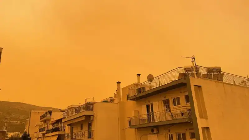
The dust originated in the Sahara Desert, one of the world’s largest sources of airborne mineral particles, and was lifted into the atmosphere strong winds before being transported northward. As it crossed the Mediterranean, the dust spread widely across the Iberian Peninsula, reducing visibility in some areas and creating a hazy sky over Portugal. Such events are not uncommon, but their intensity can vary depending on seasonal wind patterns and climatic conditions.
In Portugal, the arrival of Saharan dust has both environmental and public health implications. While the particles can contribute to nutrient cycles depositing minerals into soil and oceans, they also affect air quality, especially in urban areas. Authorities often issue warnings during such events, advising sensitive groups to limit outdoor exposure. The visual impact is also noticeable, with skies turning a muted tone and surfaces accumulating a thin layer of dust.
The NASA imagery highlights how interconnected global weather systems can be, with conditions in North Africa influencing air quality and environmental conditions in Europe within a matter of days. Researchers continue to study these patterns to improve forecasting and better prepare regions for similar events in the future. Understanding how dust travels through the atmosphere also plays a role in broader climate research, as airborne particles can influence temperature and cloud formation.
Recent years have seen increased monitoring of Saharan dust movements due to their growing relevance in climate discussions and environmental planning. Advances in satellite technology and atmospheric modeling have made it easier to observe these events in real time and analyze their long term effects. The latest images provide a detailed snapshot of one such episode, offering insight into both the scale and speed at which natural phenomena can impact regions far from their origin.


